Before the official start of field surveys, a pilot survey program is critical to test and refine survey tools, methods, and procedures and to provide training for field surveyors. Ultimately, pilots fine-tune the field recording process, help ensure data integrity, and provide more precise estimates of the number of field surveyors needed, associated survey equipment required, and recording times for a variety of heritage resources. Survey budget, schedule, and staffing can then be adjusted accordingly. Pilots also help shape public participation and outreach strategies and inform the writing of historic context statements. The pilot program may result in a revised or supplemental survey plan to address additions, revisions, or adjustments to the survey process.
Organizing Pilot Surveys
The pilot program will represent a microcosm or subset of the larger survey effort and test all aspects of the survey process from training field surveyors to submitting final data and reports. The number and selection of pilot surveys may depend on the size and scope of the survey but generally will include a range of resource typologies and historic contexts/themes within one or more geographic areas (fig. 9.1). SurveyLA, for example, included three pilot surveys: two tested specific themes, and a third tested multiple themes within a large and diverse neighborhood.

Based on the SurveyLA experience, when organizing a pilot survey program, consider surveys that test:
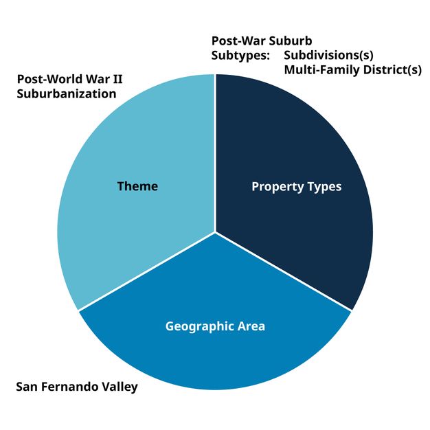
- Themes that have an expected high yield of significant resources. SurveyLA included a pilot for a subset of the city’s expansive post–World War II residential neighborhoods (fig. 9.2). This pilot helped establish field and research strategies for surveying postwar historic districts and assessing integrity and significance thresholds for postwar housing as a whole. The pilots also helped focus the approach for writing the Post–World War II Suburbanization historic context statement.
-
Geographic areas that have a high density of historic sites and an expected high yield of significant resources. These pilot areas may require more surveyors, time, and other resources than less dense areas.
-
A range of topography, such as hillside neighborhoods and less accessible areas, as these circumstances could ultimately slow down surveyors and impact estimates of survey times.
-
Themes, geographic areas, or resource types that focus on identification and evaluation of resources relating to ethnic and cultural histories. This type of testing will assess the effectiveness of the associated outreach strategies for public participation and engagement, the success of which may vary considerably from community to community.
Managing Pilot Surveys
The following are general tips and recommendations for managing a pilot survey program:
-
An ongoing log is a critical tool for systematically tracking issues experienced during the pilot survey. The log can be organized by categories relating to survey equipment and software, data collection and editing standards and procedures, research approaches, application of historic contexts, outreach strategies, and so forth (fig. 9.3). The log can also be used to track aspects of the survey that are particularly successful. Logged information could include date and time of recording, name of survey team member, summary of issue, date resolved, and notes. Use of a log can continue into the official field survey phase of a project, as was the case for SurveyLA.
SurveyLA Issues Log: Sample Page NO. SURVEYOR SURVEY AREA MACHINE DATE ERROR CATEGORY ISSUE DESCRIPTION (Attach screenshots on separate page) SCREENSHOT STATUS RESPONSE DATA COLLECTION SYSTEM 1 GPA WA GPA1 4/2/08 Data Collection System Too many district contributors It appears that there is a limit to the number of contributors that can be added to one district. At approximately 700 entries, the Leimert Park district ceased to allow new contributors to be added, instead providing an error that says 'Unable to load photos for the resource.' GPA #B Resolved Resolved 2 HRG HW HRG1 4/2/08 Data Collection System Adding a resource type When trying to add a second property type to an individual resource, the surveyor received an error message stating that "Object Reference not set to an Instance of an Object." With this error, the surveyors were unable to move forward, or to close the "View Resources" screen. This problem appears to have been related to the character limit in the "General Comments" field noted above, as the issue was resolved once the General Comments text was edited. N/A Resolved Resolved 3 HRG, ARG, P&T HW, WA N/A 4/2/08 Data Collection System Confirmed properties Properties that have been "confirmed" cannot be viewed, edited, or deleted. HRG #1; ARG #2 Outstanding This will not be added, a training issue. 4 ARG WA ARG1 4/2/08 Data Collection System District error When working on a district, it isn't possible to exit the district tool and work on something else and then come back (an error message pops up). Select District by Name-> First window of district comes up-> clicked “contributors” -> error message pops up. ARG #3 Outstanding Dave could not replicate on ARG. 6 P&T ST PT1 4/3/08 Data Collection System Object reference error When switching from working on a district to an individual resource, an error occurs P&T #2 Outstanding Dave could not replicate on ARG. HISTORIC CONTEXT STATEMENT 7 HRG HW N/A 4/2/08 HCS/CTPs Residential Development context Currently, the "Residential Development" context focuses on groups of properties (freeway suburb, streetcar suburb, automobile suburb), with character-defining features and eligibility standards relating to neighborhoods and subdivisions. It would be useful to be able to evaluate individual properties under this context as well. Perhaps a “Residence” property type should be added to each of the suburbanization themes. N/A Outstanding 8 HRG HW N/A 4/2/08 HCS/CTPs Fire Stations theme Under the "Institutional Development" context, "Fire Stations" theme, there is only one sub-theme, for Post World War II Fire Stations. It would be useful to have an additional sub-theme for earlier fire stations (pre-1947). N/A Outstanding 10 HRG HW N/A 4/2/08 HCS/CTPs Entertainment context Under the Entertainment context>Housing & Neighborhoods, the property type is single-family residence, but the eligibility standards are written for a district. It would also be useful to have a multi-family and district property type for this theme. N/A Outstanding 12 ARG WA ARG1 4/3/08 HCS/CTPs American Colonial Revival style Architecture->American Colonial Revival -> Early. One of the eligibility standards is: "May display multiple roof dormers". This should be a CDF, not an eligibility standard. N/A Outstanding OTHER 13 P&T ST PT1 4/3/08 Other Tablet Startup Error occurs "SQLDUMPER library failed initialization" P&T #1 Outstanding 14 P&T ST PT2 4/3/08 Other Photography Some issues with capturing adequate photographs of properties due to parked cars along the sidewalk and garbage bins left out for garbage collection. N/A Resolved FIGURE 9.3 During SurveyLA pilot surveys, a log was created to record issues encountered by survey team members during field recording. Los Angeles City Planning Office of Historic Resources -
Regular survey team meetings are advised to discuss issues encountered during the pilot survey, such as those recorded in the log referenced above. The resolution of issues can then be prioritized and assigned to team members as needed.
-
The pilot survey program can help assess the general capabilities and quality of work of varying field surveyors. The information gleaned can be important in selecting the best qualified surveyors and survey teams moving forward.
-
Pilot survey areas may need to be resurveyed later, or the data modified in whole or in part, based on lessons learned and revisions to survey methods. For SurveyLA, all pilot survey areas were either resurveyed or the data thoroughly reviewed and revised to ensure consistency in content and quality with all final survey results.
The pilot survey program ends with developing survey reporting procedures and report formats that will serve as prototypes for those published after the official survey phase is completed. Survey reports are discussed further in chapter 11.