Today, organizations worldwide are undertaking heritage surveys largely driven by the need for up-to-date, accessible, and comprehensive inventories within their area of interest or administrative jurisdiction. The need for a survey may be brought to light in response to a range of factors: natural disasters, urban planning initiatives, redevelopment projects, community activism, and others. In some cases, the need for a survey is apparent, such as when a survey has never been completed in a geographic area or jurisdiction and when no inventory exists. In other cases, the need may be based on existing heritage information that is limited in scope, lacks relevancy and currency, and is not easily accessible.
A needs assessment can provide a baseline analysis of the content of existing information on heritage places, identify or confirm information gaps, and help define the scope of a new survey. The assessment may be broad based, such as one for a large-scale areawide survey (e.g., SurveyLA; see chapter 5), or focus on topics of immediate concern, such as at-risk resources associated with new development or other activities. Considerations for completing a baseline analysis are discussed in more detail below.
Oftentimes the need for a survey is concurrent with the need to develop a new inventory or to modernize, update, and enhance an existing one. Considerations for building and modernizing inventories are discussed in part I. See also the section in chapter 7 relating to the elements of a survey: Technologies for Data Collection and Management.
A needs assessment can originate as a stand-alone activity for a new survey (Howe, Kathryn Welch. 2001. Los Angeles Historic Resource Survey Assessment Project: Summary Report. Los Angeles: Getty Conservation Institute. https://www.getty.edu/conservation/publications_resources/pdf_publications/lahrs_summary_report.html) or can be the result of a broader study to evaluate the state of a preservation or heritage conservation program (see Philadelphia Historic Preservation Task Force. 2019. Key Recommendations of the Philadelphia Historic Preservation Task Force: Final Report. https://www.phlpreservation.org/_files/ugd/c0d485_4b1083963b1344c9aa60986bb0acf2d4.pdf; Portland Historic Landmarks Commission. 2018. State of the City Preservation Report 2018. https://www.portlandoregon.gov/bds/article/698934).
Participants in a Needs Assessment
Participants in a needs assessment include, at a minimum, a project manager to design a research strategy and lead the process and team members to complete tasks such as compiling information, research, and analysis. These roles may be filled from internal personnel of the agency or organization supporting the assessment, by consultants, for instance heritage professionals and information technology specialists, or both.
It is also recommended that the assessment process include a public participation strategy to engage individuals and a range of community groups, organizations, and institutions with knowledge of the survey area and with interests in shaping the focus and content of a survey. Importantly, the needs assessment phase can be the start of a successful program for long-term public engagement in a survey and associated inventory.
Assessing Existing Heritage Information
Existing heritage information may be available from previous surveys, nominations for resource designation or listing, and other data collection activities. Existing information may also include historic contexts, thematic studies, and thematic frameworks (see the sidebar on this subject in chapter 2). While ideally this information is contained within an associated inventory, it may also be the case that no inventory exists or an existing inventory is not comprehensive. Compiling information outside of an inventory can be a challenging and time-consuming process, particularly if the information is of substantial quantity, in disparate locations, and differing in format, quality, and usability.
The following are questions to consider when completing a baseline analysis with respect to the content and usefulness of existing heritage information both within and outside of an inventory.
-
What geographic areas, temporal periods, heritage themes, and resource typologies are represented?
-
Conversely, what are the information gaps with regard to geographic areas, temporal periods, heritage themes, and resource typologies—those that are not represented or are underrepresented?
-
What designated or listed resources are represented?
-
What information is no longer current or relevant and in need of updating?
-
Were applicable professional standards and guidelines used to collect the information, and have they changed over time?
-
Was the public engaged in information-collecting activities? If so, in what ways?
-
What formats are used (e.g., paper, digital)? Are they adequate?
-
Are formats outdated or obsolete?
-
If so, what resources are needed (time, staff and/or consultants, funding, technology) to make the information usable for digital data collection (e.g., data entry, conversion, consolidation)?
-
-
Are there copyright considerations to utilizing existing information such as images and photographs?
Survey Scope and Approach
The needs assessment can help inform survey goals and objectives, which in turn help shape the survey scope and approach. Goals and objectives may address the purpose, benefits, and value of the survey and projected outputs in terms of the kind of data the survey will yield and the users and uses of such data. The scope defines the geographical area(s) and boundaries to be surveyed, historic and/or prehistoric time period(s) of heritage resources to be covered, and one or more themes/topics and associated resource types to be included (fig. 6.1).
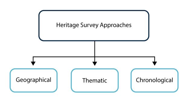
While all three of these aspects are present in every survey, typically one will provide the basis for the overall survey approach and focus, and ultimately the type of survey to be undertaken.1
-
A geographically based approach focuses on identifying resources in a specific area, which may be a whole or only part of an administrative jurisdiction. Geographically based surveys are commonly carried out in advance of regional or local planning initiatives and development or redevelopment activities. Such an approach may also be undertaken in the aftermath of a natural disaster or armed conflict or in response to climate change (as discussed in chapter 12). Sometimes an entire geographic jurisdiction is covered, for example, where no inventory exists, the inventory contains minimal information, or where no prior surveys have been completed. Area-wide surveys typically include a range of relevant themes and resource types. SurveyLA is an example of a geographically based survey that provided comprehensive coverage of the entire city of Los Angeles (see chapter 5).
-
A thematically based approach focuses on gathering information on particular themes and associated resource types. This approach may be used to address underrepresented topics and resource types in an inventory or ones that are absent from previous surveys and other data collection activities. Thematically based surveys are also completed to address heritage types determined to be at risk to help ensure that they are adequately recorded and considered in decision-making, for their protection. A thematically based approach is being increasingly used to address community interests in inventories that more fully represent an area’s complexity and diversity. Examples include surveys designed to document marginalized ethnic and cultural histories or newly recognized heritage types, such as intangible heritage.
-
A chronologically based survey may focus on resources developed during or dating from a specific period of time. Today, such an approach is particularly relevant in cases where heritage surveys have not been completed for a substantial amount of time, so the recent past and modern-era themes and resource types have never been recorded.
Decision-making in the early phases of a project regarding the survey approach provides the framework to begin the survey planning process.
Notes
-
The National Park Service discusses these three approaches in the National Register Bulletin How to Complete the Multiple Property Documentation Form (National Park Service. 1999. How to Complete the National Register Multiple Property Documentation Form. Washington, DC: U.S. Department of the Interior. https://www.nps.gov/subjects/nationalregister/upload/NRB16B-Complete.pdf). Although the approaches are introduced in relation to developing historic context statements, they are also useful for organizing survey work. ↩︎